Maps

Here you can find maps and images associated with the DIG project. The main goal is to develop a reliable geothermal resource map of Ireland. Updates will be posted here.
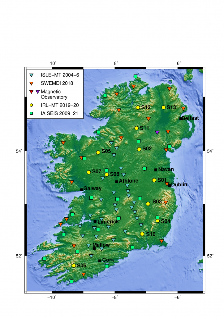
Map of Ireland showing the locations of MT stations and Seismic stations currently used in the DIG project. Added to this will be active source measurements and gravity data and additional seismic and MT sites in localised areas such as at the Mallow warm springs.
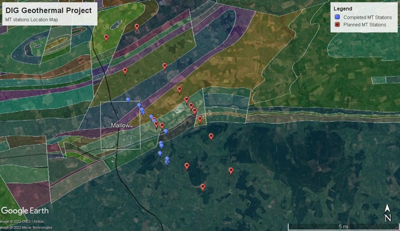
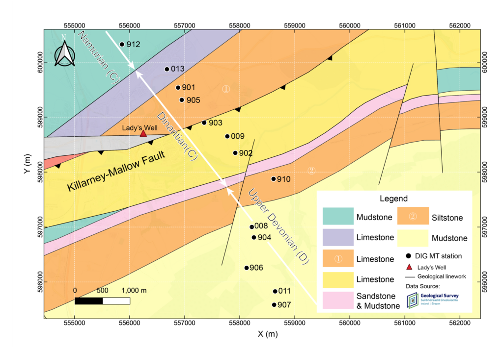
Location of our first MT profile. It crosses the Killarney Mallow Fault Zone which is a potential fluid conduit for geothermal extraction. We have oriented it perpendicular to the fault zone. It also is close to Lady’s Well, a warm spring that is ~19 degrees celsius year round.
Location of our second profile for MT. It crosses the two fault zones that are potentially suitable fluid conduits for geothermal extraction.
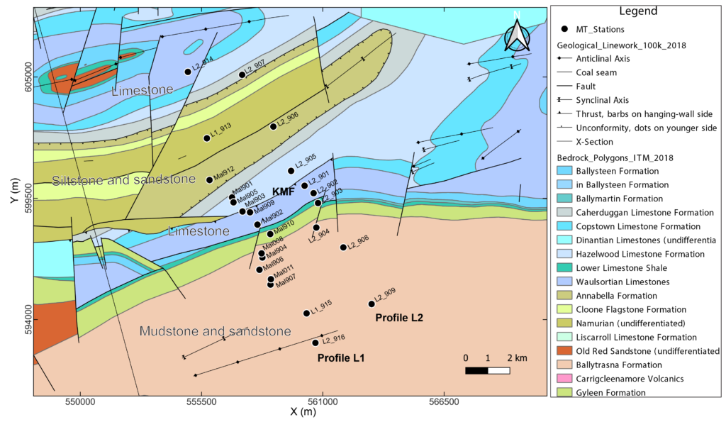
Geological map of the two completed MT profiles. The original profile was extended to image depths >5 km and a second profile was included to check the consistency of features laterally along the fault zone.
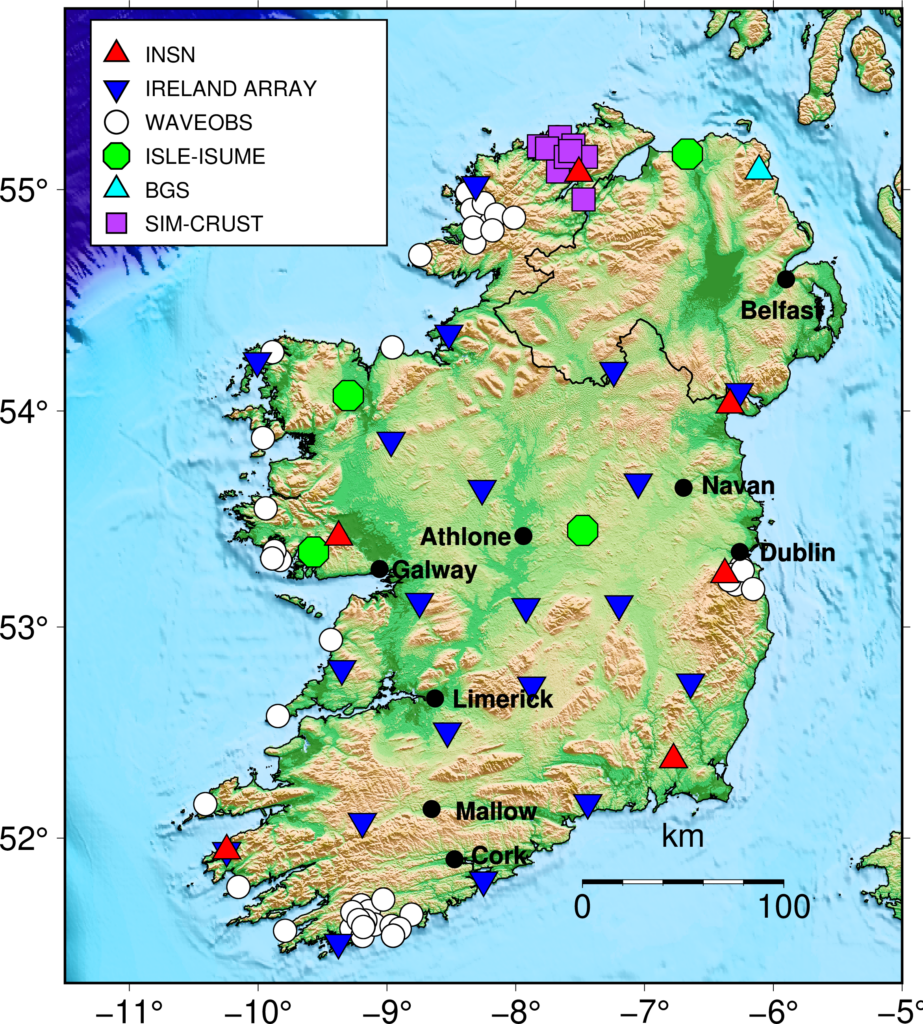
All seismic stations used in Ireland for the seismic component of the DIG project.